







Storm retweeted

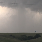
Broad tornadic circulation near Saddle Mountain, OK, lots of little spinups and power flashes underneath the main meso. Fun local chase with the highlight being 80mph RFD a few minutes after this photo. #okwx @NWSNorman

Storm retweeted

Spotr 1 miles SSW of NORMAN, OK @ 00:46 UTC Rotating Wall Cloud>-Rotating wall cloud southwest of my position. Saw in the lightning – at Norman, OK
Storm retweeted

6:56pm- Randlett, Oklahoma (Cotton Co.) @NWSNorman @kevinselle @kfdx3wx @MBohlingwx #okwx #texomawx #txwx #severewx
Storm retweeted
Spotr 8 miles W of BOONE, OK @ 23:29 UTC Damage>-Metal barn blown apart. Every power pole snapped. Power lines strewn about. My exact location – at Oklahoma, USA

Storm retweeted

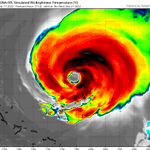
Tropical Storm #Henri Advisory 18: Henri Expected to Become a Hurricane By Saturday. Storm Surge and Hurricane Watches Issued For Portions of The Northeastern United States. go.usa.gov/W3H
Storm retweeted

#Henri is heavily sheared at the moment, but it will be entering a very favorable environment in about a day. Two upper-level troughs will force dual outflow channels, which should allow for pretty rapid deepening assuming Henri isn't completely decoupled.
Storm retweeted

The vast majority of ECMWF ensemble members now show the capture scenario with #Henri and bring it back close to New England. The strong->west and weak-> east spread is still there, though, and matters because a weaker storm making a wider pivot would have lower impact.

Storm retweeted

If you are in the Northeast, you need to prepare for Tropical Storm #Henri. Storm surge, flooding & high winds will affect parts of New England and Long Island this weekend.
Ocean swells may cause life threatening rip currents starting tomorrow. Follow @NHC_Atlantic for updates.

Storm retweeted

Looks like we have some tornado damage from that debris signature in Thompson, CT – at Boston, MA

Storm retweeted
Watching the progress of #Henri but trends aren't good for SNE.
Time to start thinking about plans today and possibly putting some preps into action by this eve/tomorrow – at Boston, MA


Storm retweeted
Tropical Storm #Henri Advisory 13: Henri Maintaining Intensity With 70 Mph Winds. Interests in the Northeastern U. S. Should Monitor Its Progress. go.usa.gov/W3H
Storm retweeted

It's that time of the year! Starting today, we will be launching weather balloons every six hours for at least the next several days to collect additional upper air data. These extra obs help to improve model tracks for tropical systems, allowing for more accurate predictions.


