

Husband to an amazing Wife | Father | Meteorologist - B.S. Iowa State | Storm/Aurora Chaser | Chase Archive Member | Storm Chaser Academy Coach
Greeley, CO
Joined February 2013
- Tweets56.6K
- Following2.1K
- Followers14.7K
- Likes90.7K




Pinned Tweet
I *cannot* believe this was real. These colors were real. I've never seen such a deep blue Aurora before. I've seen blue Aurora, but my goodness this was something else. What a beautiful night.
Oh, and yes, the snow is purple from the Aurora light reflection, I kid you not.
Central Colorado last night/early this morning. #cowx #aurora

Hunte☈ Fowkes retweeted

Half dollar sized snowflakes falling this morning near Melbeta, Nebraska @KNEBStormCenter @NWSCheyenne #newx
Hunte☈ Fowkes retweeted

Hey folks.
The Twistex memorial on google maps has been completed overrun with AI slop, Roblox videos, random memes, and fancams(?).
Please do me a favor and report any photos that aren't actually of the memorial.
Thank y'all ❤️
maps.app.goo.gl/eJ8UibPcmwvX…


Hunte☈ Fowkes retweeted

El Niño snowfall patterns 1950-2026.
I anticipate a lot of “winter cancel” opinions after Christmas, but the party will just be getting started!
History says interior Northeast first, then the coast follows late season.


Our local church held a trunker treat tonight with food and trick-or-treating and the Fowkes won best family costume!

Hunte☈ Fowkes retweeted

Parents, please check your kids' Halloween candy this year. I just found the announcement to discontinue the NAM and HREF and replace them with the RRFS in this Snickers bar

Hunte☈ Fowkes retweeted

It seems like a signal for the return of potential severe weather is possible closer to Halloween as ensembles depict a trough digging over the Western CONUS with sufficient moisture ahead of it. Trends will need to be monitored to see if this changes, but it's worth watching!
Hunte☈ Fowkes retweeted

As of this date, this is how the current El Nino event compares to the last 3 Super-Ninos
Absolute beast. Has been dominant over tropical weather this summer/fall and expect the Lower 48 pattern to get much stormier later in November.


I find it strange that, according to some, an individual can't be both, critical of potential failings from the National Weather Service as well as be a strong supporter of them to improve and be the absolute best in the business. At the end of the day, humans make mistakes, I do, you do, we all do.
Something I don't like is when one side weaponizes something against another branch of this career field. So much ego and defensive arguing to what end? If it was up to me, there would be no speration in Meteorology and everyone would be working together for the betterment of society and protection of life and property. When did we go wrong where it's you vs us or us vs them? Why the divide? Why can't everyone hold each other to higher standard and work towards a common goal together? What a concept.
Looks like we may have had an unwarned tornado east of San Mateo, NM, where a strong couplet occurs and then a substantial CC drop on the next scan. Not much, if any, notable population near this area of rotation. #nmwx
Hunte☈ Fowkes retweeted

4.5" in Mayer, AZ on Sep 28, 1995
The hail apparently killed 500 turkeys
ncei.noaa.gov/access/storm-e…


Hunte☈ Fowkes retweeted

I don’t know what the state record hail size is in Arizona but this is nearly an inch wide than my iPhone. West side of Sedona.


Hunte☈ Fowkes retweeted

Yesterday's supercell outbreak in Arizona was quite the sight to see. Severe thunderstorm warnings were active for nearly 24 hours, and the towns of Prescott, Flagstaff, and Show Low all received tornado warnings. Heber-Overgaard was even directly struck by a likely tornado.
Oh my gosh


Hunte☈ Fowkes retweeted

Just an amazing supercell approaching Show Low right now. #azwx @NWSFlagstaff

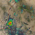
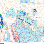
It'll be curious to watch where this storm goes after it got done hail dumping on Glendale. Given the overall environment as it goes up mountain slops/the Rim, I expect this storm to make a run at producing tornadoes as the environment sees lower bases and slightly stronger, more favorable shear.
Currently, the storm is in an environment for large hail with strong deep-layer shear and higher bases. Go upslope towards Payson, and the LCLs low and shear seems to get slightly more supportive of a tornado threat. Time will tell; this is one to watch closely over the next couple of hours. #azwx


