

Exploring the geography and history of Ethiopia and the surrounding region through maps, data, and visuals.
- Tweets1.9K
- Following168
- Followers1.9K
- Likes6.6K
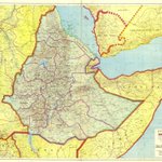




ALT Ethiopia Prepared and Published by the Ethiopian Mapping Agency Addis Ababa, 1985

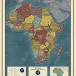
ALT Africa By the National Geospatial Intelligence Agency Springfield, Virginia, 2024 Inset: Country information and comparison showing the land area of Africa encompassing China, India and United States.

ALT Ethiopia: Road Map By the Ethiopian Transport Construction Authority (E.T.C.A.) Planning & Programming Division Printed by the Ethiopian Mapping Agency Addis Ababa, 1984

ALT Ethiopia, Eritrea, and Somaliland: Cross-Country Movement Conditions for Tracked Vehicles By the Central Intelligence Agency Washington D.C., 1960

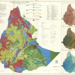
ALT Hydrogeological Map of Ethiopia By Tesfaye Cherinet, Teshome Kumbi, and Belete Habteselassie Published by the Ethiopian Institute of Geological Surveys Printed by the Ethiopian Mapping Authority Addis Ababa, Ethiopia, 1993


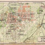
ALT Map of Asmara By the Touring Club Italiano Published by Vallardi 1929, Milan


ALT Map of the Course of the Nile, Comprising Egypt, Nubia, Abyssinia, and the Red Sea By J. Andriveau-Goujon Paris, 1858

ALT Road Map of Addis Ababa By A. Anderson Bell Published by Addis Ababa City Planning Department Addis Ababa, September 1955

ALT European territorial claims on the coasts of the Red Sea By Rawson William, Weller, Edward Published by Edward Stanford, Proceedings of the Royal Geographical Society London, 1885 Inset: Gulf of Tajura, Obock, Assab Bay, Sheikh Syed and Perim Island


ALT Asia: Southwestern Sheet By Colton G. Woolworth (George Woolworth) Published by J.H. Colton & Company New York City , 1858


ALT Map of Abyssinia By The Bombay Gazette Published on October 26, 1867, as a supplement map for the gazette Mumbai, India

ALT Northeastern Africa By F. Handtke and Karl Sohr Published by Carl Flemming Glogau Leipzig, 1846

ALT Central and North Africa and Arabia By Adolf Stieler, Heinrich Karl Wilhelm Berghaus Published by Justus Perthes Gotha, 1836 The map is a finely detailed, hand-colored engraving, composed of two main sheets joined to depict a broad swath of Central and North Africa alongside the Arabian Peninsula. The mapping is rigorous, with carefully delineated borders, rivers, mountain ranges, and major settlements. Major regions such as the Sahara Desert, Nile River Valley, Ethiopian Highlands, and the Arabian Peninsula are prominently featured. In the lower right, there is an inset labeled "Habesch," which focuses on Ethiopia and Eritrea. This inset map details the complex topography and political divisions within the region, highlighting its significance and the European interest in the area during the 19th century.

