






MNStorm retweeted

Playing around with some visualizations: Here is a volume rendering of one of the plumes we measured this summer with the @wildfirecenter's Ka-Band Doppler radar during @NASA's #INSPYRE. This was the McCully Fire in Oregon.


MNStorm retweeted

Global model ensembles are in strong agreement that a prolonged &anomalous nearly West-wide autumn heatwave will develop this week & persist for 10+ days. While some daytime records may be set, this event will be more notable for its persistence & breadth. [Thread]

ALT Map showing predicted temperature anomalies in early October from the ECMWF ensemble across the western U.S. Nearly the entire region is painted red and pink, indicating widespread very warm anomalies.
MNStorm retweeted
#Pileus clouds forming atop #pyrocumulus were observed during #INSPYRE. These clouds are indicative of rapidly growing convection linked to intense fire. Co-located radar observations reveal the powerful updrafts (~20 m/s) driving their formation. science.nasa.gov/?p=1422768 via @NASA


MNStorm retweeted
The ECMWF seasonal ensemble has just updated for September, and it continues to suggest that a soon record-strength El Niño will exert a very strong tilt in the odds toward wet conditions across the U.S. southern tier, including all of California, the Lower Colorado, and SE U.S.

ALT Plot showing data from ECMWF SEAS5 seasonal model September update. It depicts the most likely "tercile" of precipitation during Jan-Mar 2027, and California is painted as "upper tercile" with 70-100% confidence.
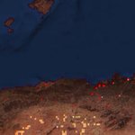
This has flown under the radar but the wildfires in Algeria are among the deadliest in history. According to local sources the death toll might be as high as >308, which would make it the deadliest wildfire event in 90 years. The fires also burned 359,731 acres. #wildfires


MNStorm retweeted
Although it has dropped out of news in recent days, wildfire activity across western U.S. and SW Canada remains very high, with numerous large fires active. Fires are now more broadly distributed vs. early in the summer, stretching from central CA to southern BC & east to ID/MT.

ALT Snapshot of current wildfire activity (red/orange/yellow thermal detections) and clouds as viewed on Wednesday evening. Via NOAA's Wildland Fire Data Portal.
MNStorm retweeted

My goodness. We are doing this again. Bryson, TX needs to be watching this very closely! Likely 5 miles south of Hwy 380 moving quickly NNW.
MNStorm retweeted
#RossFire is pissed off again tonight as winds increase for the second straight night. Fire continues to move north towards Hwy 380. 8:30pm


