

Forecaster at the Storm Prediction Center @NWSSPC | US Marine Corps Veteran | Penn State Meteorology | Opinions are my own.
Oklahoma, USA
Joined July 2018
- Tweets576
- Following563
- Followers1.1K
- Likes4K




Harry Weinman retweeted

251 Years at the Tip of the Spear
For 251 years, Marines have met every fight with resolve, precision, and an ethos that never wavers. The first to fight and the last to yield. America sleeps well because Marines stand the watch.
Happy Birthday, Marines. Semper Fidelis.
(Narrated by @netflix @mosquitobowl Director Peter Berg)
🎥(U.S. Marine Corps video by Staff Sgt. Patrick Katz)
Cyclic tornadic supercell produced tornado #1 7:55-7:57 PM CDT and then tornado #2 with satellite twin 7:59-8:01 PM CDT, approx 3-5 miles WSW Foraker in Osage County #okwx @nwstulsa @BuckeyeTSTM


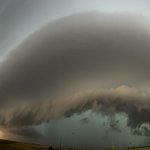
Whale’s mouth of a big HP supercell looking westward from just east of Slapout #okwx. Some of the most impressive structure on this beast. @BuckeyeTSTM


Smattering of 1-inch hail stones near the Civic Center in OKC at around 6:40pm CT, as we got clipped by the edge of this severe storm! Winds appeared to be sub-severe, but still pretty strong. @NWSNorman #OKwx


Harry Weinman retweeted

🚨9 Brand-New Hodograph Modules🚨
Hodographs are hard! Thanks to Harry @HarryWeinman & Cameron @CameronJNixon, they just got much easier! And they explain everything!!! Guess what — no Math! 😃
training.weather.gov/wdtd/co… (Storm Structures and Hazards/Storm Modes unit)


Harry Weinman retweeted

So proud to see @HarryWeinman and I's Hodograph Fundamentals series on RAC!
This was a huge undertaking to provide incoming NWS forecasters with the current "state of the science" of hodographs and storm evolution😀 Check out the "Storm structure.." tab:
training.weather.gov/wdtd/co…


Grand finale of our storm chase today near Midland #txwx. Once supercell latched onto boundary, we saw at least 2 tornado cycles. The first was a dusty tornado 510-520PM just W of @MidlandAirport, and then the big one was 640-705PM W of TX-349. With @BuckeyeTSTM @NWSMidland
Current stationary tornado in south central Midland County @NWSMidland


We saw what looked like a landspout tornado northeast of Alpine #txwx at 557PM. Intense/compact dirt swirl extended at least halfway up from ground to cloud, beneath broad midlevel mesocyclone. While hard to tell from video, presume vorticity column extends to cloud. @NWSMidland
The scene in Marathon #txwx turned into a winter wonderland shortly after temperatures were in the 90s. A supercell producing copious hail came through—hail stones reached at least quarter-size and accumulated a few inches deep. Temps fell to 40F. With @BuckeyeTSTM @NWSMidland


Saw full cycle from tornadogenesis to dissipation ENE of Windthorst tornado — approx. 2 SSW intersection Texas Hwy 172 & Deer Creek Rd — with @BuckeyeTSTM. This was with supercell tracking farther ENE in Clay County #txwx. Photo logs showed second tornado 534-541PM. @NWSNorman


A couple more videos of the Clay County #txwx tornado late this afternoon.
Also, Hi @ReedTimmerUSA!

6
1,104

