

JCI provides market information and trade consultation to various organizations regarding China’s agricultural commodities.
People's Republic of China
Joined May 2014
- Tweets5.1K
- Following1.4K
- Followers6.3K
- Likes3.5K



China's fishmeal imports down 33.11% in Jan-Oct 2026 due to El Nino impact on anchovy fishing in Peru, port stocks fall below 100,000 tonnes, but prices stall under low supply jcichina.com/article/a100731…


292
Domestic Oversupply Persisted, China Pork Imports Expected to Hit a 10-year Low This Year jcichina.com/article/a100742…


2
312
Brazilian Grains Lead China Imports in Q4 2026, China-US Trade Remains on Hold jcichina.com/article/a100683…


China's grains imports on a clear rising trend, mostly from Australia and Brazil.


🇨🇳 So far in 2026, China's corn imports have doubled from a year ago, but pork, sugar and soybean imports are below 2025 levels.
October soybean imports fell to a three-year low, but MY 2025/26 (Oct 25-Sep 26) imports were a record-large 112 mmt (4.1 bln bu).

6
485
JCIChina retweeted

It's day 54 of the streak of Nino 3.4 sea-surface temperatures breaking the previous all-time record high of 29.815°C set on November 17, 2015. Temperatures are once again above 30.0°C.
Meanwhile, the Climate 8-Ball is busy watching 1950s Sci-Fi reruns.

JCIChina retweeted

This El Niño is coming with much more ocean heat than the biggest events that came before it.
There's a much broader area of extreme warmth near South America as well as warmer waters near California and in the Gulf — factors that could add to extreme winter weather.

JCIChina retweeted

EL NIÑO 2027: ECMWF Signals a Potential Second Warming Peak — South American Crop Risks Could Extend Into Mid-Year
The ECMWF seasonal forecast is showing a potentially important development: El Niño could remain active through much of 2027, with a second warming peak emerging in the eastern Pacific around May.
Central Pacific warming is projected to peak around December–January, with positive anomalies persisting until June 2027.
But the eastern Pacific presents a different picture:
• First warming peak: November 2026
• Second potential peak: May 2027
• Region: Off the coasts of Ecuador and Peru.
This could prolong oceanic heat accumulation and extend the risk of heavy rainfall along the Peruvian coast beyond its normal seasonal window.
THE AGRICULTURAL MARKET IMPLICATIONS:
🇧🇷 BRAZIL SOYBEANS & CORN
Prolonged climate disruption could increase rainfall variability across southern and central Brazil. Excessive rainfall during harvest can delay fieldwork, increase grain moisture and quality losses, while dry spells in other regions can threaten second-crop corn development.
🇦🇷 ARGENTINA SOYBEANS & CORN
Rainfall distribution will be critical during the 2026/27 growing season. Excessive precipitation could create flooding and harvesting problems, while prolonged dry spells could threaten yields during reproductive stages.
🇵🇪 PERU & ECUADOR
Extended eastern Pacific warming raises the risk of excessive coastal rainfall, flooding and infrastructure disruption, with potential consequences for transport, storage and agricultural supply chains.
🇮🇳 INDIA
The broader concern is the persistence of ENSO-related global weather volatility. However, India's monsoon response cannot be inferred from eastern Pacific temperatures alone; the Indian Ocean Dipole and regional circulation will also matter.
THE MARKET TAKEAWAY:
Soybean, corn and soybean meal traders should not assume that the El Niño risk disappears after its initial December–January peak.
A second eastern Pacific warming pulse around May 2027 could extend weather uncertainty into the South American harvest and the next Northern Hemisphere crop cycle.
For commodity markets, the critical variables will be Brazilian rainfall distribution, Argentine soil moisture and the timing of precipitation during key crop-development stages.
One important caution: A seasonal forecast is a risk signal, not a confirmed crop-loss forecast.
The El Niño story may have a much longer market impact than its first peak suggests.
Source: ECMWF Seasonal Forecast
JCIChina retweeted

El pronóstico estacional del ECMWF mantiene a #ElNiño activo durante buena parte de 2027.
En el Pacífico central, el máximo se proyecta alrededor de Dic–Ene, con anomalías cálidas persistiendo hasta junio.
Pero en el Pacífico oriental, frente a Ecuador y Perú, aparece algo especialmente importante: dos máximos de calentamiento, uno en noviembre y otro hacia mayo de 2027.
Ese posible segundo pico mantendría una enorme cantidad de calor oceánico frente a Sudamérica durante varios meses adicionales y podría prolongar la ventana de lluvias intensas en la costa peruana varias semanas más de lo habitual.
Además, aumenta la posibilidad de llegar al invierno de 2027 con condiciones cálidas.
El riesgo no termina necesariamente con el primer pico de #ElNiño.
JCIChina retweeted

🌊 ENSO 2026–2027 Outlook: A Possible Transition from El Niño to La Niña
Based on a 21-year analog composite, incorporating some of the strongest historical El Niño events since 1950, using the @pyreweather interface and NOAA CORe data, our latest ANN-based tropical Pacific SST forecast suggests a classic post-peak ENSO transition.
📊 Key Takeaways (November 2026 – October 2027)
1️⃣ November 2026: Persistent warm SST anomalies across the central and eastern equatorial Pacific, consistent with mature El Niño conditions. Gradually fading out through February 2027.
2️⃣ Spring 2027 Transition: A rapid weakening of the warm SST anomalies and a gradual breakdown of the El Niño signal are projected after April 2027.
3️⃣ Second Half of 2027: A developing La Niña-like cold SST pattern may emerge by mid-to-late 2027.
🚦Note
The post-February appearance of cold anomalies in the western pacific equatorial region marks the onset of the discharge phase of the ENSO cycle, serving as the structural trigger for El Niño's decay and the subsequent transition toward La Niña. During mature El Niño events, weakened trade winds allow upper-ocean heat to accumulate and discharge poleward; once this heat content is depleted, cold anomalies emerge in the west and propagate eastward as upwelling oceanic Kelvin waves along the thermocline. As these subsurface cold waters lift toward the surface across the central and eastern Pacific, they erode the remaining warm surface pool while driving atmospheric convection back toward the Maritime Continent. This atmospheric shift reinstates and strengthens low-level easterly trade winds—reversing the Bjerknes feedback mechanism—which accelerates surface cooling and sets the stage for a La Niña imprint to emerge by mid-to-late 2027.
🔬 Latent Structural Evolution & Atmospheric Lag
Although tropical Pacific SST anomalies are projected to shift toward neutral or negative territory by mid-2027, the atmospheric response may not change at the same pace. Atmospheric coupling parameters and associated teleconnections can retain an El Niño imprint for several months, potentially extending into July 2027, before the global circulation gradually adjusts to a developing La Niña background state.
The Spring Predictability Barrier remains an important source of uncertainty in ENSO forecasting. The transition across spring can make it difficult to determine the eventual ENSO state with confidence. This animation illustrates the projected evolution of tropical Pacific SST anomalies across the analog composite, but the spring barrier may affect the reliability of the transition timing. Consequently, the lingering atmospheric influence of El Niño could persist longer than the SST animation alone suggests.
Although older super-El Niño seasons are represented in my climatic reconstruction, which extends back to 1645, incorporating them into the current analysis was not feasible because the present model relies on modern datasets with more consistent observational coverage.
However, using multivariable climatic indicators and broader structural analog contexts, I have identified at least 14 potential super-El Niño events before 1948 back to 1642. These candidates are part of the longer historical reconstruction, although they were not included in the current 21-analog composite.
📈 Baseline: CORe monthly climatology, 1991–2020
Data: NCEP CORe Reanalysis / Mercator.
This is an interim statistical outlook and remains subject to revision later in winter 2026 as additional observations and model data become available.
Statistical Structural Model by Mr. M @Statisticizer
#ENSO #ClimateForecast #ElNino #LaNina #Weather #WxTwitter #PyReWeather
JCIChina retweeted

COT UPDATE (as of Tue Nov 3) Managed money net positions :
🌽 Corn: -22,900 (-78,843 on the week)
🌱 Soybeans: +132,799 (-52,602)
🌾 Chicago Wheat: -88,726 (-13,866)
🌾 KC Wheat: -6,722 (-4,856)
Funds sold all four. Corn flipped net short for the first time since Jun 30 after a 7th straight week of selling, 454K contracts off the Sep record long. Soybeans posted the 8th largest weekly sell since 2006 and are half off their record. Chicago wheat is at a 9-week selling streak and the largest net short since January. KC wheat is short for a 2nd week. The spec length that carried the summer rally in corn and beans is completely gone, and wheat shorts are getting crowded. For producers, that means less fund fuel under corn and beans, but a stretched short in Chicago wheat that can cover fast on any surprise. #corn 🌽 #soybeans 🌱 #wheat 🌾 #macro


JCIChina retweeted

Très étrange…
D’un côté on observe un plateau de El Niño depuis plus de 2 semaines, mais d’un autre côté, les nouvelles prévisions viennent de décaler le pic de celui-ci de novembre/décembre à décembre/janvier… 🤔
Plateau final ou explosion de l’anomalie à venir ?


JCIChina retweeted

📉 BEARISH #MACRO PULLING AGS LOWER 🌾
AI regulation fears, ~80% Fed hike odds after +165k NFP, firm USD, weak BRL, lower Crude.
🧼 The GOOD news: After 9 COT weeks of selling, fund positioning is much cleaner. Corn now net SHORT!
👀 CPI + WASDE Tuesday. Bulls need a catalyst! 🚂💪🏼

JCIChina retweeted

November 7-8, 2013:
Typhoon Haiyan peaked as a 195 mph, 895 millibar Category 5-equivalent super typhoon. The storm is one of the strongest tropical cyclones ever recorded based on wind speed and is also one of the strongest landfalling tropical cyclones on record.
#wxhistory


JCIChina retweeted

Actualización Semanal #NOAA CPC Niño 1+2 (Costero) Anomalía récord sigue creciendo. Niño 3.4 (Global) Anomalía estable en territorio récord.


China Hog Prices Fallen Below 9 yuan Again After Half a Year, DCE Hog Futures Decline for Nine Weeks jcichina.com/article/a100602…


Argentine Corn Exports Hit a Record High of 34.2 MMT, A Challenge to US Market Share? jcichina.com/article/a100602…


China Hog Prices Approach Year-to-Date Lows, Has the Bear Market Entered a Critical Turning Point? jcichina.com/article/a100590…


5
642

Demand for Quality Grain Supports Firm Wheat Prices in China, Reports Say Chinese Buyers Inquire for US Wheat, but purchase confirmed. jcichina.com/article/a100567…

8
589
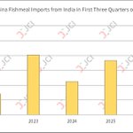
India Became Third Largest Fishmeal Supplier to China in First Three Quarters of 2026 jcichina.com/article/a100517…


4
482