

Passionné par la #météorologie, notamment de #froid et de #neige. Je publie au sujet des séquences froides en France et dans le monde #passionmétéo
Ariège, Midi-Pyrénées
Joined April 2020
- Tweets8.9K
- Following237
- Followers2.1K
- Likes11.3K



Ice Tracker retweeted

Almost a month ago I flagged late November / early December for the first potential cold spell.
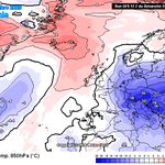
Here's the latest GEFS mean for the 1st December.
Below average across much of Europe and the UK thanks to Scandinavian blocking. Lets reel it in.


LATE NOVEMBER / EARLY DECEMBER
First cold spell?
Recent modelling has been suggesting the potential for a very early (record breaking, in fact) major sudden stratospheric warming, this is when the usual westerly circulation above the Arctic reverses to easterly, whilst the likelihood of this remains uncertain, there are other key global drivers beginning to emerge.
During early November the MJO is now forecast to emerge into the east Indian Ocean and begin progressing eastwards through the Maritimes and into the Pacific as November progresses, this will trigger a renewed rise in AAM tendency (within an already very high AAM base state, thanks El Nino!), given the lag times involved with any potential SSW downwelling, the MJO triggered rising AAM and progressing into the Pacific, you could perhaps make a reasonable prediction that the later part of November / early December would increasingly be favourable to amplification of high pressure and high latitude blocking episodes. i.e, is this perhaps the first signal of an early cold spell beginning to materialise?
A few weeks ago you'd have been pretty bold to call anything other than a +NAO, Atlantic dominated pattern through November & December, the tide does appear to be changing on that idea.
Regardless of any SSW, the possibility of a coherent MJO cycle + rising AAM would have been shifting the thinking anyway, an early SSW probably wont hurt in helping that idea along..
SUMMARY:
The likelihood of blocking / colder outbreaks late November into early December appears to be growing some traction on the back of latest developments.
Whilst a milder, unsettled & stormier outlook had been anticipated for that period initially, new developments are starting to suggest other possibilities.




Ice Tracker retweeted
🧵🥶virazón: El viento zonal medio a 10 hPa y 60°N hoy (GFS) es: 2,2 m/s.El viento zonal más débil a 10 hPa y 60°N en el registro ERA5 para la fecha de hoy es: 9,2 m/s en 2009.El viento zonal más fuerte a 10 hPa y 60°N en el registro ERA5 para la fecha d hoy es: 42,7 m/s en 2012


Ice Tracker retweeted
Recent model runs have become far more muted on the idea of a strong recovery to the polar vortex, now it looks to hit a wall around the 22nd with a renewed round of wave 2 forcing & heat flux.
Further vortex disruption to come? Probably.


Ice Tracker retweeted

🥶 Records de froid précoce à #Hokkaido, au Japon (11 novembre 2026)
Asahikawa : 🌡️ −12,5°C, T°C ≤ −12°C la + précoce depuis environ 120 ans (−13,0°C le 11 novembre 1906).
Horokanai : 🌡️ −20,2°C, T°C < -20°C la + précoce jamais enregistrée au Japon, battant record de 1988


Ice Tracker retweeted
There is a growing signal within model outputs that today’s major SSW will “drip” down into the troposphere later this month and into early December.
This, coupled with favourable troposphere teleconnections will increase the likelihood of high latitude blocking and outbreaks of cold weather during early December.

Ice Tracker retweeted
Let's learn No. 3: Atmospheric Angular Momentum (AAM)
The AAM is a very complicated topic & an area of science that is relatively new in terms of research and understanding. I'll try my best to explain the broader outline as simply as I can, but please feel free to ask questions!
The AAM forms part of the Global Synoptic Diagnostic Model (GSDM), a model designed to apply a diagnostic approach to medium range weather forecasting, whilst it can't tell you specific weather on specific days it's instrumental in predicting broad-scale weather patterns in the 2-3 week range & sometimes a little beyond that.
Today, i'll focus solely on the AAM. Atmospheric angular momentum (AAM) is a measure of how fast the atmosphere rotates around the Earth's axis.
A faster atmospheric rotation = a positive AAM, a slower atmospheric rotation = negative AAM. It's essentially a measurement of momentum within the atmosphere when averaged across the globe.
Various weather events can either add or remove westerly momentum from the atmosphere and the MJO (previously discussed) is a big player in this, when the MJO progresses eastwards through the Maritime Continent frictional torque generated against earths surface acts to slow down earths rotation, energy must be conserved however so this momentum transfers into the atmosphere and the result is we see an increase in atmospheric momentum.
The largest player in adding or removing momentum however is mountain torque. During a positive mountain torque event, large mountain ranges are "bumping" into areas of higher pressure, this slows down earths rotation and that transfers momentum into the atmosphere. (please see linked tweet thread in the reply to this for a more detailed explanation on mountain torque) Mountain torque always proceeds frictional torque.
The opposite to the above is also true, the MJO returning to the Indian Ocean sees a return to negative frictional torque with negative mountain torque following, this does the opposite to a positive event and removes westerly momentum, transferring that momentum back into earths rotation and out of the atmosphere.
During La Nina, AAM is typically negative due to an increase in the easterly trade winds across the Pacific (less westerly momentum), the opposite is true for El Nino, weaker easterly trade winds tend to produce positive AAM.
You can however see positive AAM during La Nina, or negative AAM during El Nino, these are often called "mini ENSO cycles" and are more broadly driven by the MJO.
Complicated. How does this tie into weather patterns?
A very rough rule of thumb is that a positive AAM (increased westerlies) tends to produce a more wavey/amplified jet stream which increases areas of blocking high pressure in the mid/high latitudes, a negative AAM does the opposite and produces a flatter, more zonal jet stream.
The direction of travel is often more important than the total. For example; total AAM could be negative but certain events are adding westerly momentum to that atmosphere & thus AAM tendency (direction of travel) is positive.
You also need to account for "where" those positive or negative anomalies are heading. Are they moving towards the equator? In which case this tends to enhance sub-tropical highs and we see a stronger Azores high and often milder weather, or are those anomalies moving towards the poles? In which case blocking in the higher latitudes is more likely. I've annotated the AAM tendency chart (2nd image) to try and show this.
You also need to account for phasing of the MJO, does this align with the current direction of travel with the AAM? For example; let's say the MJO is in phase 6, this typically correlates to high latitude blocking, but AAM anomalies are moving towards the equator, this goes against the idea of high latitude blocking.
Two opposing signals make the medium range forecast more uncertain. Looking at the MJO alone, you'd expect blocked patterns but the AAM is telling a different story, this is why it's important not to take the MJO in isolation.
When both of these drivers are in alignment however, you can be far more confident in the medium range forecasting space in terms of the broader pattern, often being able to flag the potential for "high impact weather" far earlier, albeit on a broader scale, specific details of when/where/how bad will always be reserved for shorter range forecasting & models.
I hope this explanation makes at least some sense & explains why AAM plays an important role in medium range forecasting. Any questions please feel free to ask.
Next time: Frictional Torque & Mountain Torque.


Ice Tracker retweeted
Up.. up and away.
Huge injection of momentum into the Pacific jet at the moment courtesy of an off the charts East Asian Mountain Torque event.
This will lead to an incredibly strong Pacific jet stream but equally, this will cause undulations and waves to form as the jet moves eastwards into America and interacts with the Rockie mountains, enhancing those waves, ultimately leading to an anticyclonic wave breaking event in the Atlantic or towards Scandinavia.
The MJO continues to sit in phase 2 (Indian Ocean) increasing in amplitude with expectation of eastward progression into phase 3 by mid November.
A major SSW with u-wind reversal in the stratosphere takes place in the next 2-3 days with modelling predicting these negative anomalies will “drip” down into the troposphere late November into early December.
What does this actually mean?
INCREASED LIKELIHOOD OF BLOCKING and cold weather outbreaks through the first two weeks of December with high latitude blocking perhaps developing across Scandinavia initially before retrogressing west towards Greenland as we see a sharp correction of the AAM to negative tendency once this +EAMT event wanes, I.e the signal for a retrogressive pattern.
Potential beyond that (Mid December onwards) for a return to unsettled, Atlantic driven weather given sharply declining AAM tendency combined with a rebounding stratospheric vortex.


Ice Tracker retweeted
The MJO looks to be on the move east through the first half of this month at a relatively strong amplitude.
This, combined with a likely +EAMT event gives me doubt over a rapid stratospheric vortex recovery.
In any case, further disruption seems plausible during the second half of November.
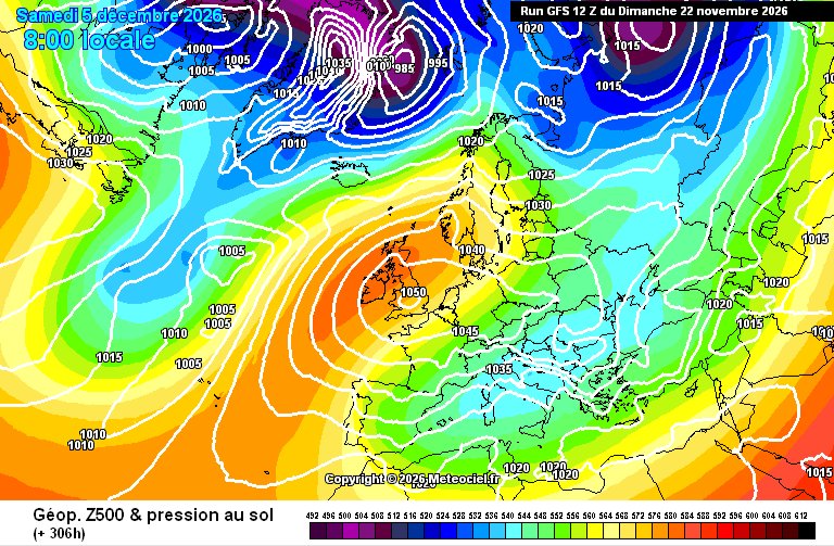
Late November / early December continues to look interesting from a blocked and potentially cold point of view across NW Europe.


Ice Tracker retweeted

Tonight, we livestreamed the latest CANSIPS seasonal model update, which seems to be going for extreme northern blocking and negative NAO/AO for winter 2026/27.
If this MSLP anomaly didn't yield a cold, maybe very cold winter, I'd be shocked.

Ice Tracker retweeted

December 2009 stands out as a cold -NAO/-AO analog, following an early-season SPV slowdown, against seasonal guidance.
ag2trader.com/1-15days/?blog…
#energy #trading #weather #seasonal #forecast #risk #market #portfoliomanagement #temperatures #cold #ssw #stratosphere #polarvortex

Ice Tracker retweeted

Arctic Polar Vortex could break down as the 10 hPa wind at 60°N may reverse to easterly into early November.
The AIFS Ensemble shows 6% chance (3 members out of 50) while full physics EPS at 18/50 = 36%
Weather + GIS:
Polar Vortex Earth --> polarvortex.earth/


Ice Tracker retweeted

Maybe the word "unprecedented" is overused in weather/climate but the forecast of the strong weakening of the #PolarVortex in early November is truly without precedent. My stratospheric AO forecast disappeared at -4 SD! Good timing for a PV blog tomorrow! published.aer.com/aoblog/aob…

Ice Tracker retweeted
LATE NOVEMBER / EARLY DECEMBER
First cold spell?
Recent modelling has been suggesting the potential for a very early (record breaking, in fact) major sudden stratospheric warming, this is when the usual westerly circulation above the Arctic reverses to easterly, whilst the likelihood of this remains uncertain, there are other key global drivers beginning to emerge.
During early November the MJO is now forecast to emerge into the east Indian Ocean and begin progressing eastwards through the Maritimes and into the Pacific as November progresses, this will trigger a renewed rise in AAM tendency (within an already very high AAM base state, thanks El Nino!), given the lag times involved with any potential SSW downwelling, the MJO triggered rising AAM and progressing into the Pacific, you could perhaps make a reasonable prediction that the later part of November / early December would increasingly be favourable to amplification of high pressure and high latitude blocking episodes. i.e, is this perhaps the first signal of an early cold spell beginning to materialise?
A few weeks ago you'd have been pretty bold to call anything other than a +NAO, Atlantic dominated pattern through November & December, the tide does appear to be changing on that idea.
Regardless of any SSW, the possibility of a coherent MJO cycle + rising AAM would have been shifting the thinking anyway, an early SSW probably wont hurt in helping that idea along..
SUMMARY:
The likelihood of blocking / colder outbreaks late November into early December appears to be growing some traction on the back of latest developments.
Whilst a milder, unsettled & stormier outlook had been anticipated for that period initially, new developments are starting to suggest other possibilities.
Ice Tracker retweeted
This is the MSLP (Mean-Sea-Level-Pressure) anomaly from Copernicus long range suite member, CMCC...
If that did not deliver a cold February to western Europe, I'd be shocked...
I'll be LIVE 🔴 at 6pm tomorrow with the ENTIRE Copernicus suite...
See you then, yeah? 👌


