




Pinned Tweet
I did an interesting search and found all the SSWs from 1958 to today (excluding only the FW). With many correlations to QBO, ENSO and MJO phase!
@PvForecast @judah47
docs.google.com/spreadsheets…


Although I still have some doubts about a possible reversal of the ZWs at 60°N at 10hpa (SSW), a remarkable and rare event, there is the possibility of a -NAO with an increase in the PNA. SSW or not, towards November the atmospheric circulation over the NH will change.


Christian retweeted

Maybe the word "unprecedented" is overused in weather/climate but the forecast of the strong weakening of the #PolarVortex in early November is truly without precedent. My stratospheric AO forecast disappeared at -4 SD! Good timing for a PV blog tomorrow! published.aer.com/aoblog/aob…

Christian retweeted

🌍🌀 Another successfully anticipated, unusual Polar Vortex Sudden Stratospheric Warming (SSW) event for November!
This event is unusual and relatively rare, and its potential occurrence has been on my forecast radar since June 2026—four months in advance. My approach integrates climatic teleconnection indices, the Arctic Oscillation (AO), the Quasi-Biennial Oscillation (QBO), and, most importantly, space-weather indices, examined under a Granger-causality framework with permissive model-misspecification assumptions.
I hope this achievement will not be mistaken for bragging. Since the late-November 2025 SSW, I have anticipated five such events successfully in a row. At this point, the real reward is not the adrenaline of another successful forecast; it is the opportunity to demonstrate what long-range statistical forecasting may be able to achieve.
🎯 The real message for scientists, climatologists, and weather enthusiasts is this:
The popular claim that weather cannot be predicted beyond five days is an oversimplification. Although conventional deterministic weather forecasts face rapidly increasing uncertainty with lead time, this does not mean that all aspects of the atmosphere become unpredictable beyond that horizon.
The climate system has memory. Its atmosphere, oceans, stratosphere, solar-related variability, and other interacting components can preserve signals that help identify recurring patterns and probabilistic tendencies months ahead. ENSO binary paradigm and super-elnino is a total oversimplification, the universe of atmospheric phenomena has black, white and degrees of white and grey in between, neglecting the grey is what makes those deterministic models fail with fanned out margin of error across time.
The key is understanding which signals matter, how they interact, and under what conditions previously observed physical patterns may recur or reoccur.
Long-range forecasting is not about claiming certainty. It is about extracting predictive information from the climate system that conventional approaches may overlook.
🌀 The challenge is not simply to predict tomorrow’s weather, but to recognize tomorrow’s atmospheric possibilities months before they emerge.
#ClimateScience #WeatherForecasting #SSW #PolarVortex #StratosphericWarming #Teleconnections #SpaceWeather #LongRangeForecasting #StatisticalForecasting
@judah47 @severeweatherEU @Recretos


❄️🌀🌎 Early November 2026 — Stratospheric Warming Signal
Early-November Polar Sudden Stratospheric Warming (SSW) Signal | 3–10 November 2026
The latest structural-analog analysis is showing a notable increase in the likelihood of a possible early-November sudden stratospheric warming episode during 3–10 November 2026, with the signal particularly pronounced across the Eurasian and North American sectors. This early November SSW had also oddly materialized in November 2025, which is considered a rare event .
The forecast is based on 20 candidate structural analogs for November 2026, with the resulting pattern remaining robust after resampling across 10 independent random-season ensembles.
The 10-hPa temperature composite shows a pronounced positive temperature anomaly across the Arctic/polar stratosphere, with the strongest warming extending through the Eurasian and North American sectors.
The accompanying 100-hPa vector-wind composite also indicates a highly disturbed circulation pattern around the polar region, providing additional evidence of an anomalous large-scale dynamical configuration during the same period.
⚠️ Important: This is not a confirmation of an SSW event. At this stage, it represents an analog-based probabilistic signal. Confirmation would require the dynamical evolution to produce the characteristic weakening and/or reversal of the 10-hPa polar-night jet, particularly in the zonal-mean winds near 60°N.
The next level of verification is therefore to examine the 10-, 30-, 50-, and 100-hPa circulation structure, including the evolution of the polar vortex and the potential role of upward-propagating planetary wave-1 and wave-2 activity.
If the temperature and wind signals remain dynamically coherent as we approach November, the case for an early-November stratospheric disruption becomes considerably stronger.
🔹 Forecast window: 3–10 November 2026
🔹 Method: Structural Analog Modeling + Random-Season Resampling
🔹 Candidate analogs: 20
🔹 Validation: 10 independent random-season ensembles
🔹 Primary diagnostic: 10-hPa polar temperature
🔹 Dynamical support: 100-hPa vector-wind structure
See the previous forecast for Nov SSW signal found from June in the comments please .
Statistical Model by @Statisticizer
🔋Powered by Aviatech Jordan & UAE-Dubai — Poultry Farm Equipment & Integrated Farming Solutions
Aviatech Jordan
aviatech-mena.com/allservice…


Christian retweeted
Crazy stuff from model #PolarVortex forecast! GFS is all over the map but seems to want to settle on a Canadian Warming (consistent with forecast for North American weather). Meanwhile ECMWF doesn't waver from a near full PV spit which is bonkers this early in Nov! Blog on Monday


Christian retweeted

LATE NOVEMBER / EARLY DECEMBER
First cold spell?
Recent modelling has been suggesting the potential for a very early (record breaking, in fact) major sudden stratospheric warming, this is when the usual westerly circulation above the Arctic reverses to easterly, whilst the likelihood of this remains uncertain, there are other key global drivers beginning to emerge.
During early November the MJO is now forecast to emerge into the east Indian Ocean and begin progressing eastwards through the Maritimes and into the Pacific as November progresses, this will trigger a renewed rise in AAM tendency (within an already very high AAM base state, thanks El Nino!), given the lag times involved with any potential SSW downwelling, the MJO triggered rising AAM and progressing into the Pacific, you could perhaps make a reasonable prediction that the later part of November / early December would increasingly be favourable to amplification of high pressure and high latitude blocking episodes. i.e, is this perhaps the first signal of an early cold spell beginning to materialise?
A few weeks ago you'd have been pretty bold to call anything other than a +NAO, Atlantic dominated pattern through November & December, the tide does appear to be changing on that idea.
Regardless of any SSW, the possibility of a coherent MJO cycle + rising AAM would have been shifting the thinking anyway, an early SSW probably wont hurt in helping that idea along..
SUMMARY:
The likelihood of blocking / colder outbreaks late November into early December appears to be growing some traction on the back of latest developments.
Whilst a milder, unsettled & stormier outlook had been anticipated for that period initially, new developments are starting to suggest other possibilities.

Christian retweeted

Breaking News!
Code UFB!!!
It takes 2 weeks to confirm ocean sea surface temperatures and the long wait is finally over. The first day in recorded history with Nino 3.4 SST at or above 30.0°C is now officially on the record.
October 7, 2026: 30.000°C.
climatereanalyzer.org/clim/s…

As mentioned, temporary phase with strengthening of PV after a strong weakness with a phase of +NAO/BL with a temporary block between the Atlantic and the UK with cold air towards the Balkans/Middle East which could subsequently evolve into a phase of -NAO


Christian retweeted

The surface in the nino regions is realizing more of the subsurface warmth, while cooler water continues to build in the western Pacific. There is still room for further strengthening but we are getting close to the peak in the next month or two.
Christian retweeted

We're headed for an El Niño that is — quite literally — off the charts.
WMO's Global Seasonal Climate Update shows that El Niño is forecast to exceed the scale of global monitoring charts. Its impacts will be felt well into 2027.
Read the full update: bit.ly/4z2MhwQ
Christian retweeted

Some follow-up info here...
The theme for the past 6 winters or so has been (at least) one major outbreak of arctic air across the entire US, despite forecasts for a warmer than average season. Just because the general 3-month forecast is for a warmer winter, that doesn't mean cold and snow are out of the question, even into the deep south.
Of course, there's no guarantee we get the same this winter, but weather patterns tend to repeat...


Bit of a long post here, but we are certainly watching toward early/mid November for a potential weakening/stretching of the polar vortex into North America.
Obviously way too early to talk specifics, but any time we see model guidance approaching record-low strength for the polar vortex, we should keep our eyes open.
In general, there's 3 main possibilities with such PV disruptions:
1. A temporary stretch, then recovery
The vortex elongates, but the westerly winds subsequently strengthen. This would be an interesting early-season disruption but would not have any substantial, lasting influence on winter.
2. A more substantial wave-2 disturbance
Two distinct vortex lobes become established, the circulation slows substantially, and the disturbance extends into the lower stratosphere. This would be a more consequential signal to monitor for possible later impacts into late November/early December.
3. A sustained disruption with downward coupling
The negative polar-cap height anomaly or associated circulation changes propagate downward, potentially favoring a negative Arctic Oscillation (AO) and more persistent high-latitude blocking. This is the scenario with the greatest potential to influence North American winter patterns, although the location of the resulting cold still depends on the tropospheric response.
Also important to remember, a major SSW (sudden stratospheric warming) is conventionally identified by a reversal of the zonal-mean zonal wind at 60°N and 10 hPa from westerly to easterly. A stretched or even split-looking vortex does not, by itself, meet that criterion. Still, you don't need some big-time SSW to get cold weather into the US.
Moreover, a favorable stratospheric signal might temporarily alter the background pattern, but it doesn't automatically eliminate any milder periods or guarantee snowstorms. We would still need the right surface-low track, thermal profile, and timing (take the winter of 2015-16 for example; we got the perfect timing for one big storm in the East, but outside of that, it was a lame, warm winter).
tl;dr, this could be an interesting signal to monitor for early winter especially, but it isn't a forecast-changing event. just something to watch as we get into late fall

Christian retweeted
Loading: El Niño's strong subtropical jet 🚀
Some Northeastern cities could see their longest dry streak in two years through the end of the month. But November looks much different.
A strengthening Pacific jet will likely flip the pattern, bringing stormier weather to many.
Christian retweeted
@LesterMackey & I wrote a @Nature Research Briefing for our new article on using AI to improve subseasonal forecasting. It provides a concise & easy to understand summary, some behind the scenes information & a great ending quote from editor @MWClimateSci
nature.com/articles/d41586-0…

Christian retweeted

😮 Comparing El Nino’s Current State: 2026 makes 1997 look like Child’s Play!
Who lived in #Florida in 1997-1998? I was a whipper-snapper weatherman in #Tampa back then.
It was a crazy winter. The strongest El Niño on record brought Florida’s worst #tornado outbreak and more than triple the normal winter rainfall. 🌧️
In the image below I made an apples to apples comparison of sea surface temperature anomalies on Oct 20th. I thought it would reveal a closer comparison. Instead it shows 2026 is simply in a league of its own. Thus we expect big impacts on the winter weather. It’s important to note though that every El Niño event is different. We know it will be very active and wet in Florida, but we simply don’t know exactly how and where it will materialize. Tornadoes are more likely, but not guaranteed. It will be rainier than normal, but 3-4X like 1997? We just don’t know yet. #elnino #elniño

Christian retweeted

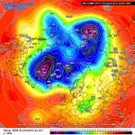
The #PolarVortex is forecast to weaken to record lows in early November, giving us something interesting to watch. The 00z ECMWF and GFS are now in pretty much perfect sync to reach well below the previous low.
For that reason, I decided to share my Polar Vortex monitoring page openly, with more products already in development. It updates twice per day, so you can track the latest Polar Vortex development yourself as we head towards Winter. 👇
severe-weather.eu/polar-vort…


Asynchrony between MJO and GWO with ocean/atmosphere decoupling as mentioned, also due to a +IOD interfering in the propagation of the convention eastwards. 1/2 ⬇️


Christian retweeted
We often now talk about the Polar Vortex, but it is not easy to visualize it in your head. For that reason I decided to make a 3D visualization from the latest GFS data, highlighting the Polar Vortex structure, and wave1/2 "attack" on the Polar Vortex in the coming days.
You can see the core separation, and the upward-style of the event.
@judah47 @Superchri90 @RyanWeather @webberweather
#polarvortex #winter
Christian retweeted

2026 RECORD SUMMER HEAT: NORTHERN HEMISPHERE 1.8°C
Global and Northern Hemisphere warming are accelerating fast.
The record Northern Hemisphere unprecedented heat waves (Europe and USA especially) will continue to increase in intensity, which will increasingly damage crop yields as well as populations and their economies. The fossil fuel industry and the evil fossil fuel subsidies from our governments must be ended.
Data (NASA GISS)
#climatechange #globalwarming
